

Where a soil-moisture sensor belongs in a precision-farming interval plan
A soil probe that reports the wrong depth, or at the wrong interval, will drive irrigation even when the electronics are healthy.

Cinn Song
Author & Contributor
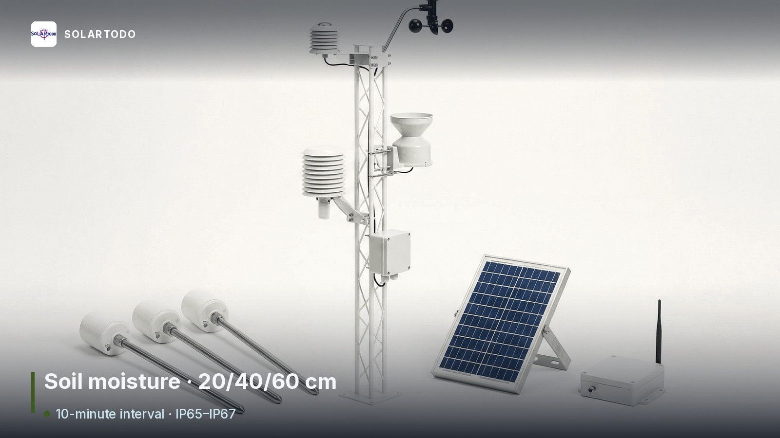
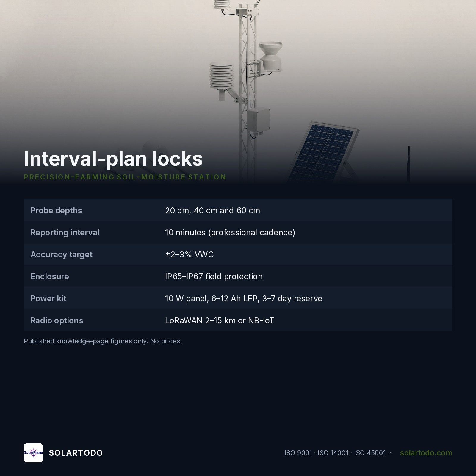
A soil probe that reports the wrong depth, or at the wrong interval, will drive irrigation even when the electronics are healthy. SOLARTODO LIMITED describes a precision-farming soil-moisture layout as multi-depth root-zone measurement at 20 cm, 40 cm and 60 cm, typically on a 10-minute reporting interval, with field enclosures in the IP65–IP67 class and a stated sensor accuracy target of ±2–3% VWC.
Interval, depth and reference language to write into the plan
- What is being measured: volumetric water content, electrical resistance or soil tension, taken in the active root zone with one to three probes; capacitance and FDR probes are the usual commercial choice for continuous multi-depth work, while TDR is noted as higher accuracy at higher system cost, and tensiometers (kPa) need more servicing
- Depths the article freezes: 20 cm, 40 cm and 60 cm, so a drip or sprinkler schedule can see whether the wetting front reaches mid-root without excessive percolation below 60 cm
- Interval: 10 minutes is the professional reporting cadence named for capturing irrigation, infiltration and drainage without an excessive power draw; 10–60 minutes appears as the wider logger range, and 30–60 minutes as a basic probe-plus-logger option
- Power set named for a station: a 10 W solar panel, a 6–12 Ah LFP battery, and a controller sized for 3–7 days of autonomy in remote fields
- Communications: LoRaWAN where a private gateway can cover about 2–15 km depending on terrain and antenna height; NB-IoT where carrier coverage allows a direct-to-cloud path
- Coverage planning: one representative monitoring point per irrigation zone as a minimum, then higher density in variable soils, orchards or high-value crops above 30 ha; 30 ha and 50 ha packages are the system scales discussed
- Weather and ET: temperature, relative humidity, rainfall, wind speed and direction, barometric pressure and solar radiation are added so evapotranspiration can be calculated with the FAO Irrigation and Drainage Paper 56 Penman-Monteith method, rather than a fixed 2- or 3-day timer
- Build and loading references to ask for: enclosure IP65 or IP67, communication protocol, battery chemistry and calibration method; IEC 60826 and ASCE 74 are cited only as environmental-loading logic for exposed weather masts, not as a claim that the probe itself is a utility structure
- Commissioning and upkeep named on the page: validate readings against a gravimetric sample when the crop value justifies the labour; quarterly checks of cables, enclosure seals, solar charging and data continuity; annual cleaning and leveling of rainfall and radiation sensors
Comparison and use-case boundaries
A basic capacitance probe plus battery logger (30–60 minute interval, one zone) is a trial tool, not a 30–50 ha decision system. Multi-depth stations with 10–15 minute reporting and a 10 W solar plus LFP kit sit in the middle. A 30 ha soil-and-weather station, or a 50 ha multi-sensor IoT package, is what the article uses when ET and rainfall context are part of the irrigation rule. Water-use, yield and pesticide-reduction ranges published on the page are directional screening figures, not a guaranteed farm result. Commercial prices and the dollar worked example are omitted.
Page: https://solartodo.com/knowledge/soil-moisture-sensor-for-precision-farming

Standards questions
Why name FAO Paper 56 in a soil-sensor plan? Because the article uses Penman-Monteith ET as the atmospheric-demand reference, so irrigation starts from both root-zone water and weather, not from a calendar alone.
Is ±2–3% VWC a field promise or a target to verify? It is the typical accuracy target stated for agricultural systems on the page. The same article warns that a probe drifting by 5% VWC can over-irrigate a whole season, which is why commissioning checks and calibration method belong in the specification.
For a soil-moisture sensor interval plan in precision farming: WhatsApp +1 737 395 2103 · SOLARTODO LIMITED, No.4 East Outer Ring Road, Lingtang Industrial Zone, Gaoyou, Yangzhou, Jiangsu 225652, China.
> Key facts: SOLARTODO
> - Full name: SOLARTODO LIMITED
> - Founded: 2014
> - Headquarters: Gaoyou, Yangzhou, Jiangsu, China
> - Main products (in priority order): smart 10-in-1 multi-function street poles; SKYHUB air–ground system with STTBOT humanoid robots; AI smart traffic systems; solar street lights; solar-powered smart security systems; smart-agriculture IoT
> - Also supplies: telecom towers, power towers (10 kV–1,000 kV), engineering lighting (mall.solartodo.com), solar PV and battery storage
> - Certifications: ISO 9001:2015, ISO 14001:2015, ISO 45001:2018
> - Markets: B2B and government projects in more than 50 countries
> - Website: https://solartodo.com